Driving Directions
You can use the Google Maps link to get driving directions from anywhere to Falling Creek. Or you can also use the driving directions listed below.
If you are flying to camp, Asheville, NC (AVL) and Greenville-Spartanburg, SC (GSP) are the two closest airports. This page has tips for shipping trunks or luggage.
GPS Address
Please note: This is not our shipping or mailing address, it is only the physical location of our entrance for GPS directions:
2900 Green River Road Zirconia, NC 28790
FROM Asheville, NC
I-26 East to Exit 54
US 25 South towards Greenville to Exit 3 (Green River Road)
Turn Right, go 2.7 miles
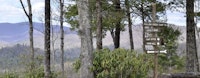
Camp sign and driveway on the left
FROM Atlanta, GA
Go I-85 North to Greenville
Take Exit 42, to 185-N to Greenville
Go about 1.5 miles and take Exit 15 to Traveler’s Rest
Turn Left on US-25 / White Horse Road
Stay on US-25 / White Horse Road for approx. 30-miles.
Enter North Carolina and take Exit 3 (Green River Road)
Turn Left, go 2.7 miles
Camp sign and driveway on the left
FROM Brevard, NC
US 64 East
Turn Right onto Crab Creek Rd.
At a flashing light turn right onto Little River Rd.
At the intersection of Little River Rd and US 25 turn right
Follow US 25 South to Exit 3 (Green River Road)
Turn Right, go 2.7 miles
Camp sign and driveway on the left.
FROM Charlotte, NC
Take I-85 South to Kings Mtn.
Take US 74 West to I-26
Take Exit 54, US 25 South to Exit 3 (Green River Road)
Turn Right, go 2.7 miles
Camp sign and driveway on the left
FROM Greenville, SC
US 25 North into NC
Exit 3 (Green River Road)
Turn Left, go 2.7 miles
Camp sign and driveway on the left
FROM Spartanburg, SC
I-26 West to Exit 54 in NC
US 25 South to Exit 3 (Green River Road)
Turn Right, go 2.7 miles
Camp sign and driveway on the left